Best Route Planning Software in 2025
This guide compares Track-POD, RouteManager, Circuit, and Upper, covering features, pricing, routing quality, and best-fit scenarios to help businesses choose the best route planning software for 2025.
Read More
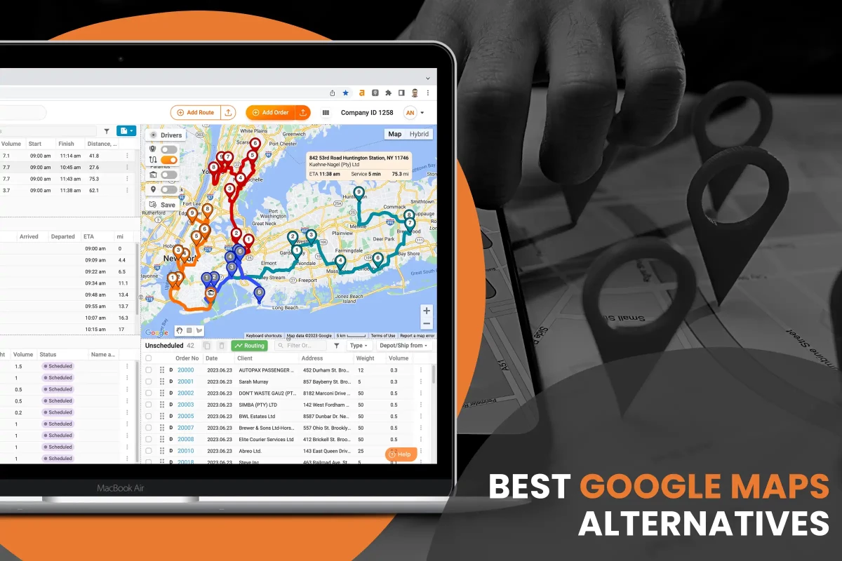
In today's quick-moving business world, planning the best way to get from one place to another is essential. Delivery businesses aim to use less fuel and keep their vehicles in good shape while making more money and keeping a good image by avoiding delivery problems.
While Google Maps is a popular choice for routing, its limitations in handling multi-stop commercial deliveries prompt businesses to seek alternatives.
Google Maps excels in providing point-to-point directions but lacks robust features for optimizing routes with multiple stops, such as considering delivery time windows, vehicle properties, and driver behavior.
Let’s discuss the best Google Maps alternatives and a rising star empowering businesses to enhance efficiency and deliver a top customer experience.
Google Maps is the best tool for general navigation. However, it poses severe limitations regarding Google Directions multiple stops, which are as follows.
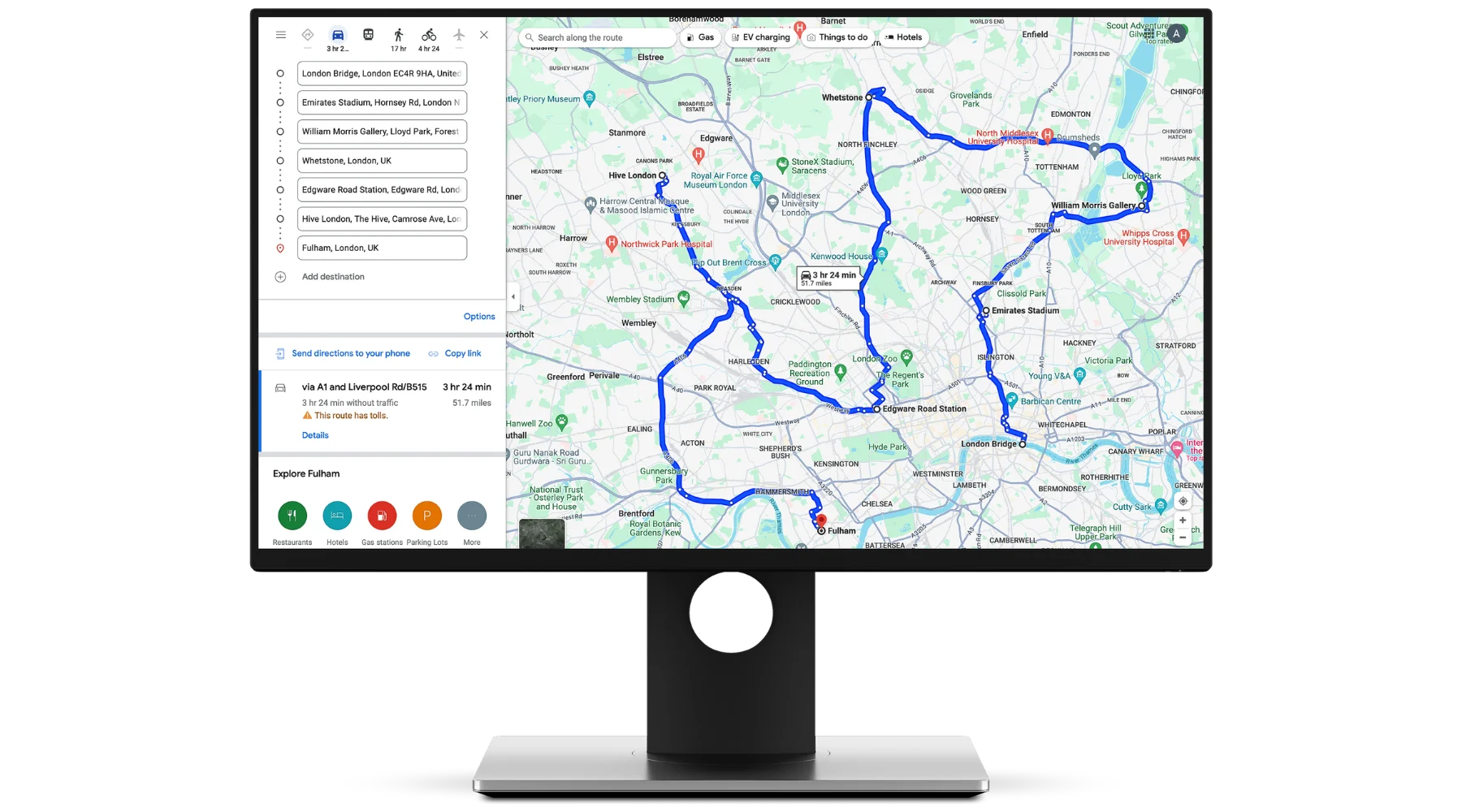
Google Maps lacks advanced route optimization capabilities crucial for multi-stop deliveries. Unlike dedicated route optimization software, Google Maps does not automatically reorganize stops to minimize overall travel time or distance.
Instead, it maintains the stops in the same order as input by the user, resulting in potentially inefficient routes. Consequently, companies with complex delivery requirements require alternative routing solutions that offer comprehensive optimization features tailored to their specific needs.
Google Maps presents challenges in integrating fleet management systems, hindering businesses' ability to synchronize delivery routes with various operational aspects.
This disconnect makes it challenging for companies to coordinate delivery routes effectively with driver schedules, vehicle maintenance tasks, and dispatching operations.
Consequently, logistics teams may face disjointed processes and heightened administrative burdens, impeding overall efficiency in managing multi-stop deliveries.
Google Maps limits the number of stops per route to just 10, which might not be enough for businesses with multi-stop deliveries. It poses hurdles for firms as they have to split the routes, which leads to increased complexity and overhead costs.
Moreover, managing multiple routes separately can result in suboptimal overall routing, as Google Maps does not collectively consider the most efficient sequence of stops across all routes.
Consequently, businesses may experience inefficiencies, delays, and higher operational costs when utilizing Google Maps for multi-stop delivery routing beyond its prescribed limit.
While Google Maps provides real-time traffic updates for individual routes, it lacks dynamic rerouting capabilities based on changing conditions during multi-stop deliveries.
This inefficiency can result in delays and disruptions to delivery schedules, negatively impacting overall productivity and customer service levels.
Google Maps carries the risk of unintentional deletion of complete routes, which may happen due to user error or unintended actions.
Unlike specialized route optimization software that often includes safeguards against such deletions, Google Maps lacks built-in features to prevent or recover from accidental route deletions.
This vulnerability reflects the importance of user vigilance and the need for additional measures, like regular route backups or implementing access controls, to mitigate the chances of data loss and ensure continuity of operations.
Commercial delivery routing requires comprehensive features to ensure efficient planning and execution of logistic operations. Some of the underlying specs are described below.
Optimizing routes gives businesses a significant edge in commercial delivery, where every minute and mile matters. It helps them save money by offering instant deliveries, keeping customers happy, and returning for more.
With well-optimization, drivers have less travel time, which reduces fuel consumption, making everything run smoother and getting more deliveries done on time.
Efficient planning of routes with multiple stops is paramount to operational success. This feature enables businesses to optimize their delivery processes and maximize resource utilization for customer satisfaction.
Multiple-stop planning is all about making delivery routes as efficient as possible. It helps companies execute group deliveries together smartly so they're not wasting time driving everywhere.
With organized stops based on how close they are, when they need to be delivered, and what customers prefer, businesses can save much time and money on transportation.
It's like putting together a puzzle where every piece fits perfectly, making everything run smoother and saving resources along the way.
When it comes to multiple stops, Google Maps doesn't fully support this feature due to a lack of advanced functionality.
Optimizing vehicle load entails strategically planning delivery routes to ensure that each vehicle is loaded to its maximum capacity without exceeding weight limits or compromising safety.

By carefully considering factors such as parcel size, weight distribution, and spatial constraints, businesses can minimize the number of vehicles required for a given set of deliveries. This reduces operational costs associated with fuel, maintenance, and labor.
Moreover, vehicle load optimization and load confirmation are crucial in enhancing delivery efficiency and customer satisfaction. By optimizing loads, businesses can ensure that deliveries are completed in fewer trips, reducing overall transit times and improving the speed of service.
Dynamic rerouting gives businesses the power to quickly adapt to different things that might affect delivery times, like traffic jams, closed roads, accidents, or sudden customer requests.
By continuously monitoring what's happening outside and inside, the system can see how each delivery route is doing and make fast changes to make things run efficiently with zero disruptions. It means deliveries arrive on time, keeping customers happy and building solid relationships with them.
Tracking drivers is a smart move for businesses to get a real-time update regarding their delivery team and whereabouts. With GPS and mobile apps, companies can keep an eye on drivers as they move through their routes.
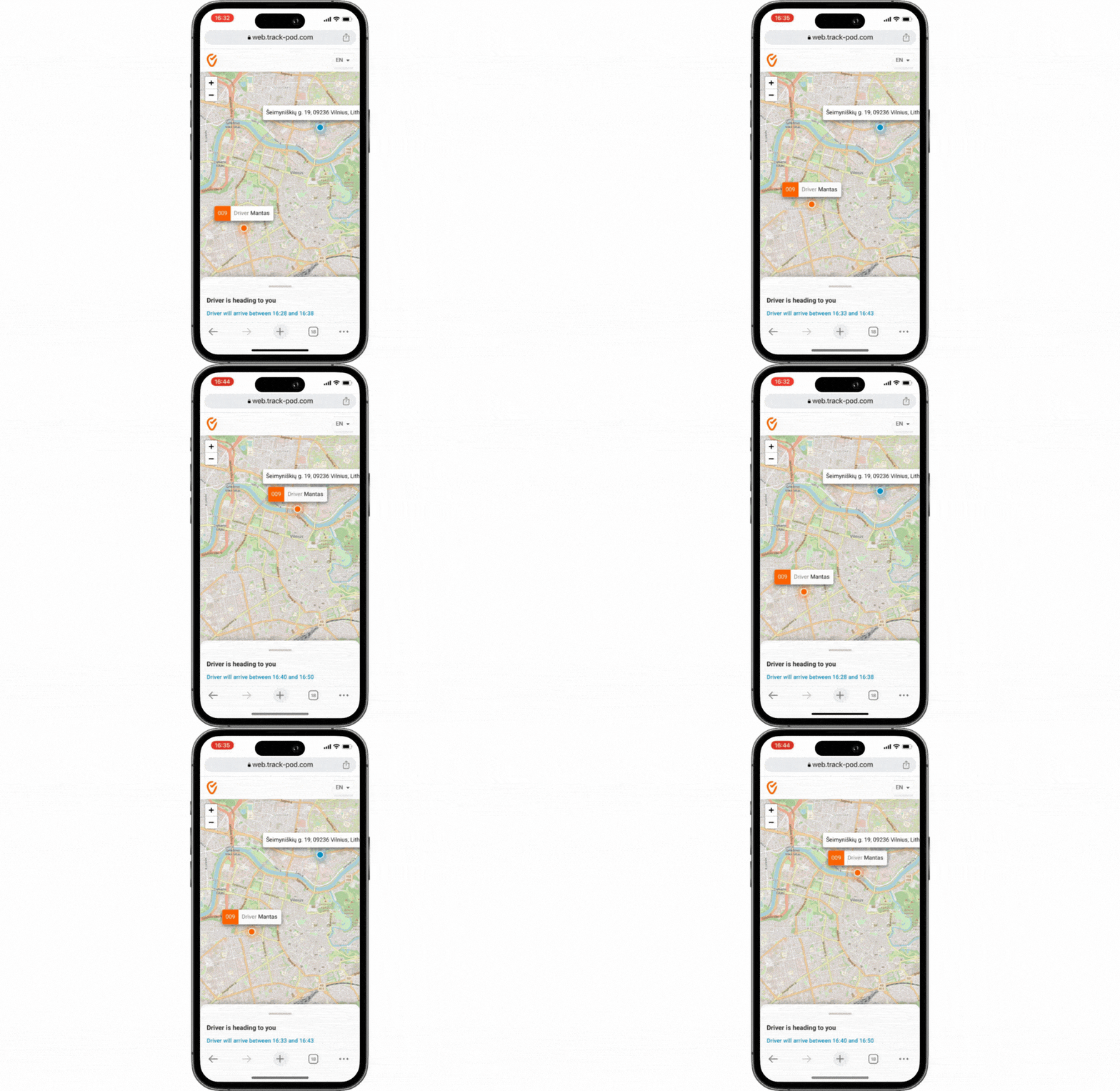
This visibility helps dispatchers make smart choices, foresee any possible delays, and deal with issues as they come up.
Plus, having the exact location of each driver at any moment means businesses can give customers accurate updates on their deliveries. This increases brand loyalty and trust, as customers feel confident about their expected delivery time.
ePOD systems are like superheroes for keeping deliveries transparent, accountable, and smooth. Instead of dealing with old-school paper stuff, these systems make everything digital.
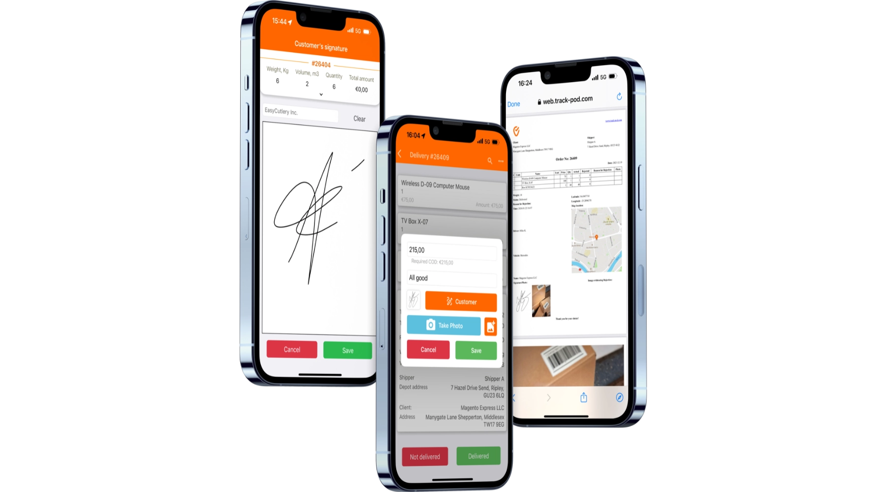
Delivery personnel can now easily snap pics, get signatures, and timestamp deliveries on their phones. It's all about making things easier and faster for everyone involved in the delivery process.
When delivery guys have cool mobile gadgets with ePOD software, they can snap proof of delivery info right on the spot as they make deliveries. It means customers get quick updates about their orders, making the delivery process transparent and trustworthy.
While Google Maps has been a popular choice for navigation and routing, its limitations for commercial multi-stop deliveries have prompted businesses to explore alternative solutions.
Several specialized routing software options offer advanced features explicitly tailored for multi-stop delivery operations, empowering businesses with efficiency and agility.
Track-POD stands out as a top alternative to Google Maps for multi-stop delivery routing, offering a comprehensive suite of features to streamline commercial delivery operations.
What makes Track-POD stand out is how amazingly efficient it is at handling every part of the delivery process, from planning routes to capturing delivery proof. It's like having a super-powered assistant that makes everything seamless from start to finish.
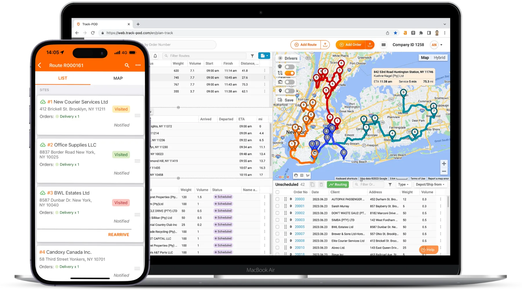
Track-POD's dynamic route planning is impressive. It considers various factors such as delivery times, vehicle capacities, and current traffic conditions to optimize routes effectively.
Moreover, it offers real-time tracking of delivery vehicles and drivers, providing businesses with constant visibility into their whereabouts and activities. This feature greatly enhances operational efficiency and ensures seamless delivery operations.
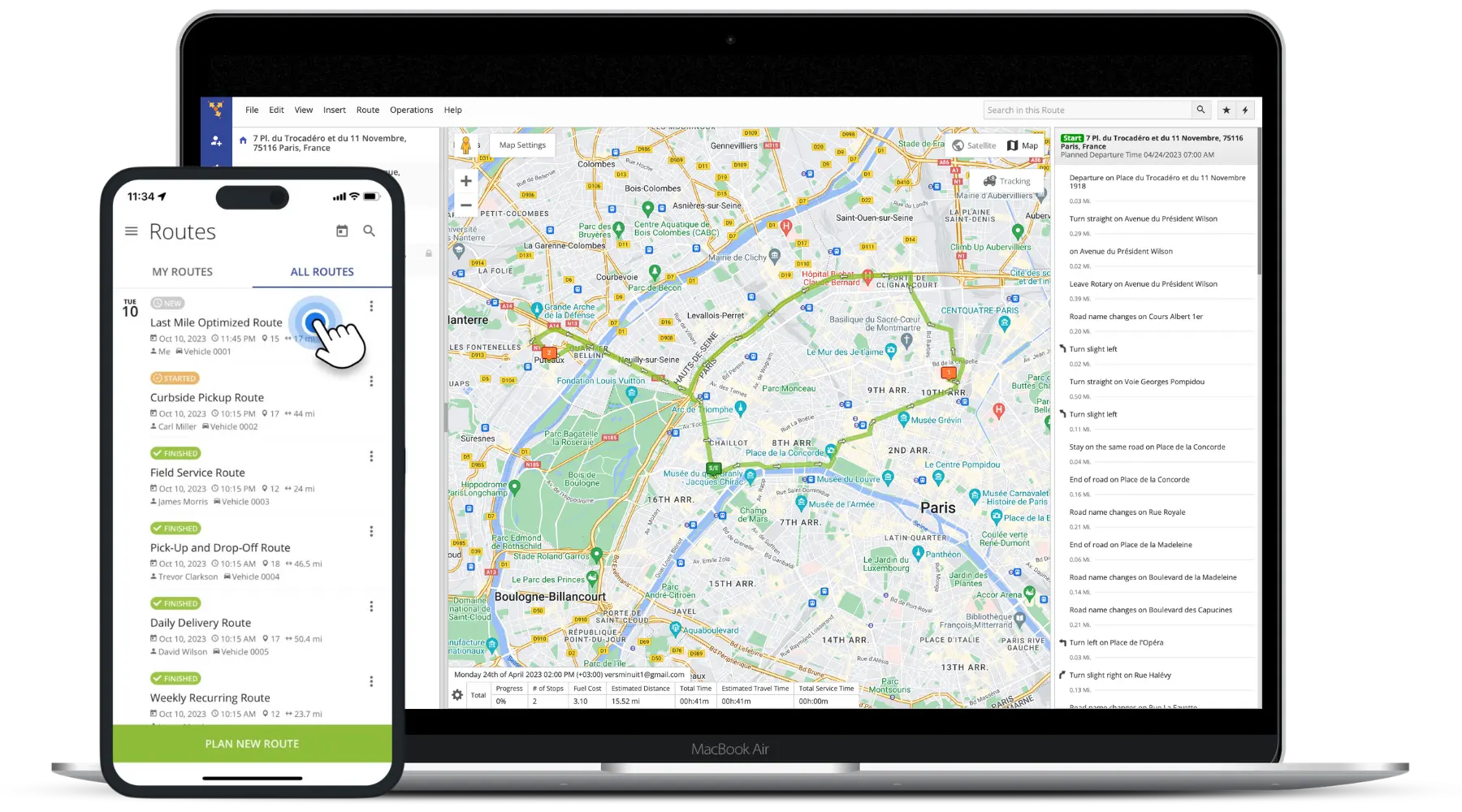
Route4Me is an effective route optimization platform that's tailored for multi-stop deliveries. What's super cool about this routing solution is that it can plan and make routes better for many vehicles and drivers simultaneously, which many others simply can't do.
It pays attention to all the little details, like when deliveries need to happen, how much space the vehicles have, and even what the traffic is like, so it can make the routes as efficient as possible.
This attention to detail helps businesses save time and resources while maximizing their delivery capabilities.
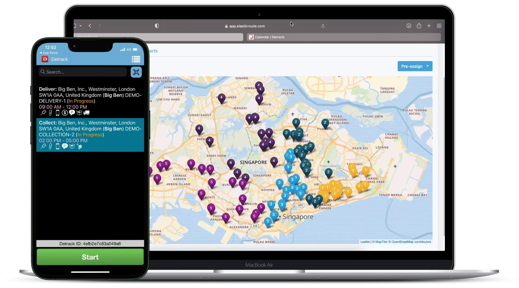
Detrack is a standout solution crafted especially for last-mile delivery operations, packed with various unique features to simplify multi-stop delivery routing. With electronic proof of delivery (ePOD), Detrack makes it easy for drivers to snap digital signatures, photos, and other delivery details from the app.
Detrack also offers advanced route optimization capabilities, allowing businesses to plan and optimize multi-stop delivery routes for efficient logistic performance. Another notable feature of Detrack is its comprehensive tracking and monitoring capabilities. This gives businesses real-time visibility into the status and location of their delivery vehicles and drivers.
Track-POD emerges as a leading option for commercial deliveries due to its array of features and capabilities that set it apart from other solutions in the market. Some of these unique attributes are described below.
Track-POD stands out as the preferred option that goes beyond basic route planning by offering advanced optimization features.
It considers various factors, such as real-time traffic updates and driver availability, to adjust routes on the fly, ensuring that deliveries are made promptly and efficiently.
The platform also enables businesses to customize their routes by simply adding or removing stops, adjusting sequencing, and optimizing routes based on changing priorities or customer requirements.
This flexibility ensures that every delivery is proper, making things efficient and keeping customers happy.
With Track-POD, businesses get an amazing view of where their delivery vehicles and drivers are in real-time, thanks to GPS tracking.
That means managers and dispatchers can monitor the progress of deliveries as they happen. This ensures everything goes smoothly and efficiently, making everyone's job more manageable.
With Track-POD's real-time tracking feature, businesses can keep tabs on where their assets are at all times. It means they can quickly react to unexpected events or delays, like traffic jams or route changes.
Track-POD allows businesses to make smart decisions and avoid any hiccups, ensuring deliveries stay on schedule without a hitch!
Through Track-POD, businesses can keep their customers informed at every step of the delivery process. The platform offers automated text and email notifications that provide customers with prompt updates regarding the status of their deliveries.
It goes when an order is confirmed, when it's out for delivery, and when it has been successfully delivered.
When the customers get their order, they also send a live tracking link and update ETA. Those who want to activate notifications via SMS need to pay a slightly additional fee.
These notifications increase transparency and communication, giving customers peace of mind and confidence in the delivery process.
Track-POD has this nifty feature called electronic Proof of Delivery (ePOD) that makes paperwork a thing of the past. It streamlines all those tedious administrative tasks and cuts down on mistakes by going digital.
With ePOD, delivery personnel can easily snap digital signatures, photos, and timestamps right in the Track-Pod app. It's like having all your delivery info in your hand.
The ePOD feature also includes customizable options for various delivery requirements and preferences. Businesses can tailor the ePOD process to capture specific information relevant to their operations, such as recipient details, delivery notes, or special handling instructions.
Google Maps is a basic navigation app that supports general routing. However, when deciding directions with multiple stops, Google Maps needs more specialized features to execute commercial operations effectively.
On the other hand, Track-POD offers a wide range of features tailored specifically for commercial delivery routing. Its dynamic route planning and optimization capabilities ensure routes are efficiently planned and adjusted in real-time to accommodate changing conditions.
The platform's electronic Proof of Delivery (ePOD) functionalities streamline administrative tasks and provide real-time confirmation of deliveries.
Even small companies with few resources can use Track-POD's unique features to improve their work and grow bigger. This goes beyond what you can do with Google Maps when planning several stops.