

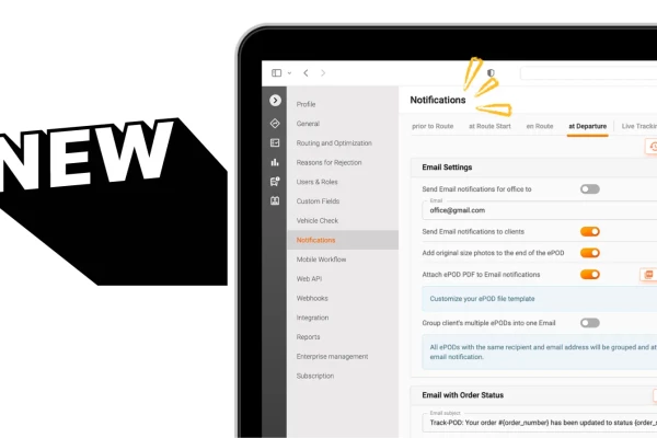
Branded customer email notifications
Delivery notifications in Track-POD Web are better than ever. Check out the new look of our notifications settings + brand-new features you can use today to get the most out of shipping updates.
Read More
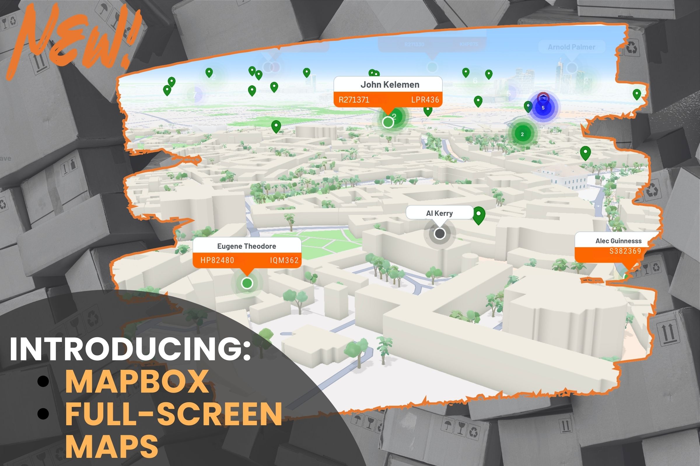
Track-POD is happy to announce the integration of Mapbox as a new mapping option — available side by side with Google Maps — within the dashboard.
Our customers need accuracy and speed. Delivery managers face frustrating delays when maps lack critical details — like exact house numbers and building entrances — that drivers rely on to navigate unfamiliar areas. With Mapbox integrated into Track-POD, you gain a powerful tool that delivers the accuracy you need, reducing errors and streamlining your route planning.
But we didn’t stop there. We’ve introduced another map-enhancing feature, Full-screen Map mode:
This mode transforms a regular dashboard field into an immersive, distraction-free view. Now, you can focus solely on the map’s fine details. It’s perfect for closely analyzing complex intersections or busy urban environments without the clutter of surrounding dashboard elements.
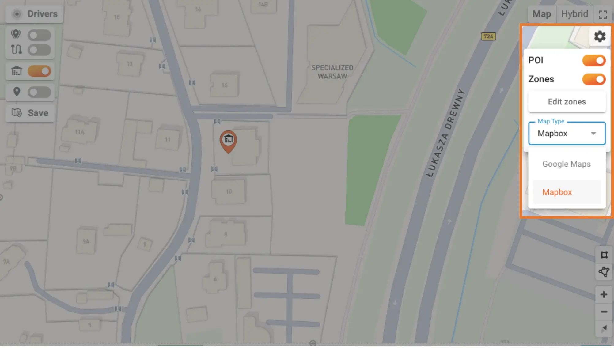
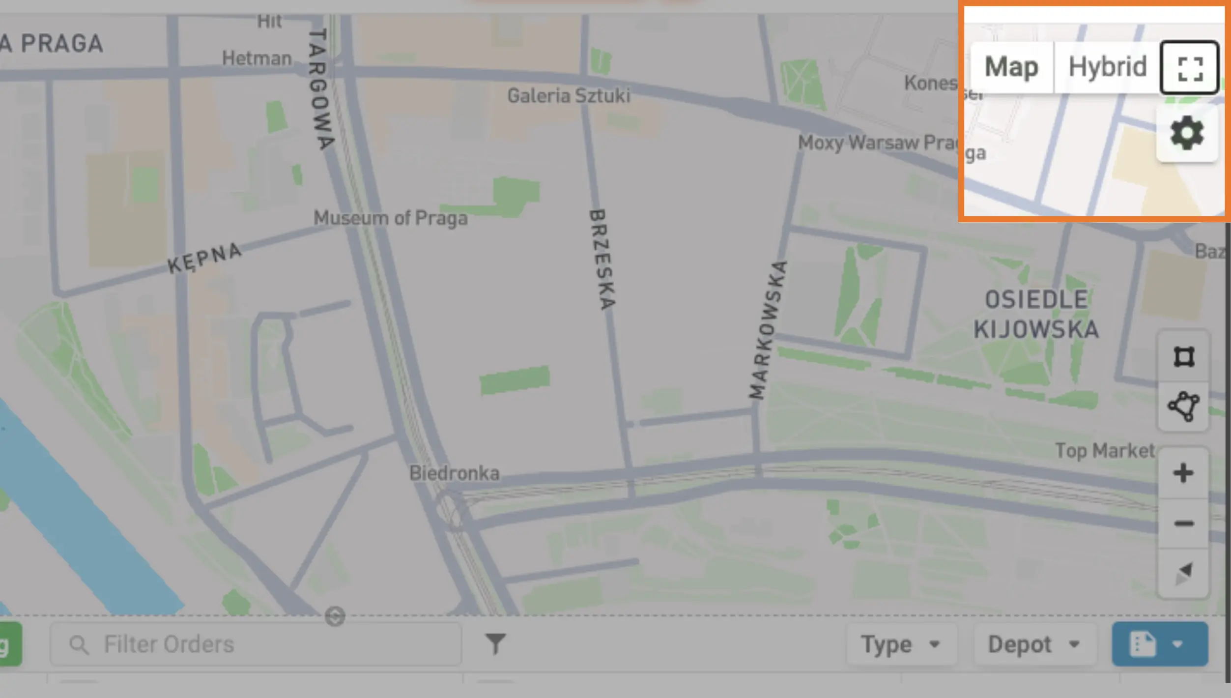
Access Mapbox by going to the Map, clicking the Settings icon and picking a different Map Type.
With a simple toggle, you can switch from Google Maps to Mapbox and get a crisp, detailed views and interactive 3D navigation:
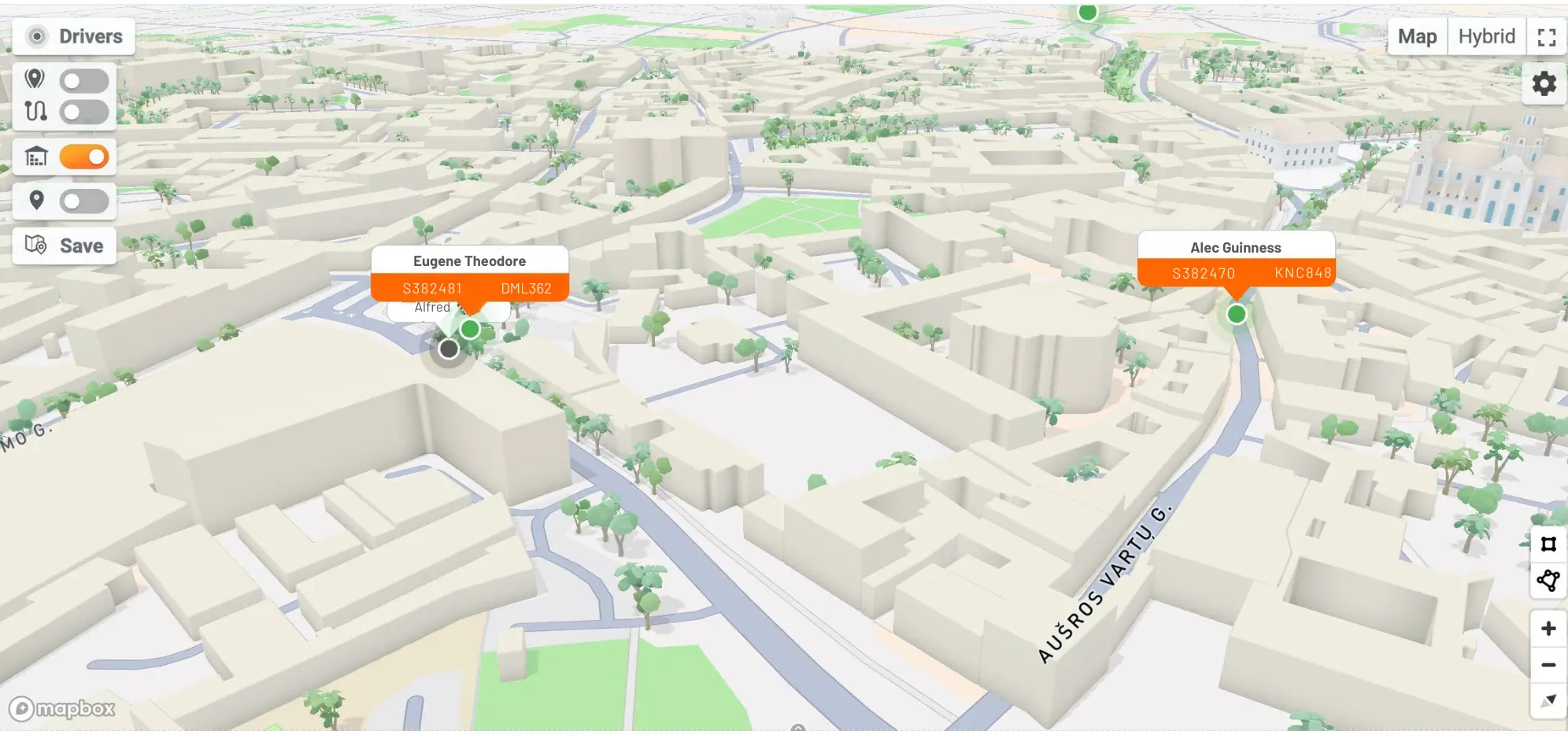
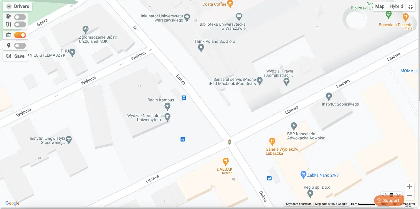
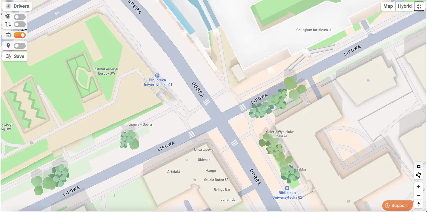
Compare the level of detail in Google Maps vs Mapbox (including details like building shapes, notable details like trees etc.).
Google Maps:
Mapbox:
Mapbox's extra detail improves our routing engine and geocoding precision, ensuring that every delivery is as efficient as possible. By offering both Mapbox and Google Maps, we give users the flexibility to choose the best tool for each unique delivery scenario. Experience the difference with Mapbox in Track-POD and see how pinpoint accuracy can transform your operations.
Delivery notifications in Track-POD Web are better than ever. Check out the new look of our notifications settings + brand-new features you can use today to get the most out of shipping updates.
Read More
Use Track-POD client portal software to create accounts for your shippers and let them add, track, print shipping labels, and download Proof of Delivery for their orders.
Read More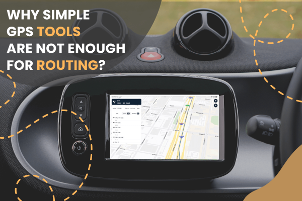
Track-POD integrates with leading navigation apps, including Google Maps, Waze, Hammer, HERE We Go, Sygic, Mapy. cz, and now TruckMap. Choose the GPS navigator that best suits your business needs in 2026.
Read More